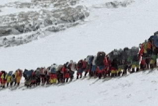
Flood-hit northern Australia is now bracing for a destructive cyclone that Queensland Premier David Crisafulli has warned could be the biggest system in living memory.
Tropical Cyclone Narelle is approaching far-north Queensland after forming in the Coral Sea, and is expected to make landfall north of Cairns on Friday.
It will unleash destructive winds, with the Bureau of Meteorology’s Sue Oats saying gusts could reach 200 to 250km/h on Friday.
“Narelle’s expected to bring heavy to intense rainfall to areas in its path, so that presents the risk of flash flooding in those intense falls,” Oates warned, noting that some of the affected areas were already saturated after heavy rain over the summer.
Areas with the most intense rainfall could receive between 200 and 450 millimetres.
The cyclone was a category-two system about 1000km east of Cooktown early on Wednesday morning, packing sustained winds near the centre of 110km/h with gusts up to 155km/h.
Cyclone Narelle is now expected to intensify into a severe category four system on Thursday, and possibly even severe category five by Thursday night and into Friday.
“A severe category-four-intensity cyclone can cause major damage,” meteorologist Jonathan How said in the BOM’s latest update on Wednesday.
“We are anticipating significant property damage – that does include roofs being ripped off, damage to vehicles, as well as loose items becoming airborne.”
Source: BOM
Queensland Premier David Crisafulli said on Wednesday that communities in the path of the cyclone were being urged to prepare “for waves, for wind, for rainfall, for flooding”.
“This may be the biggest system that many people have seen in living memory,” he said.
“And that’s why we’re asking people to prepare, as we have. And preparation doesn’t mean being alarmed, it just means doing the little things right.”
Because some of the areas potentially affected are remote, Cristafulli urged people to share the warning and check on friends and family.
State disaster coordinator Chris Stream also stressed the danger posed by the cyclone.
“I appreciate that Queenslanders in the far north are used to facing extreme weather events,” he said.
“However, at the estimated category-five crossing, we should not underestimate the potential for loss of life.”
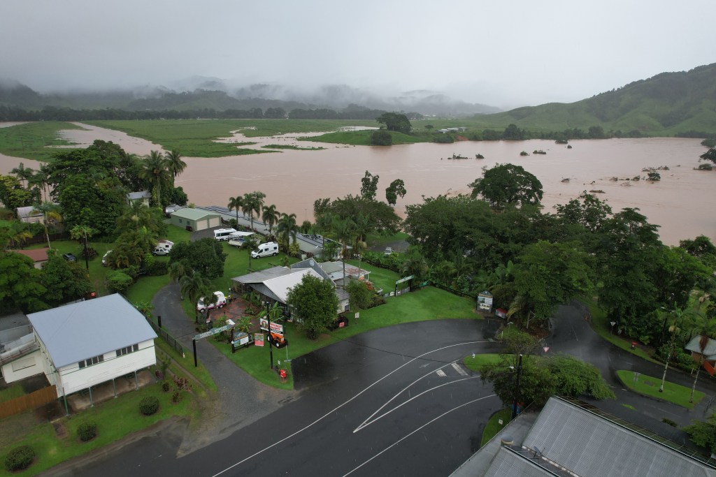
Already flooded areas of north Queensland are now facing more wild weather.
Queensland is still reeling from flooding caused by back-to-back storm systems.
A tropical low caused record-breaking rainfall across the state’s north and west in February.
Another low crossed the far north coast earlier in March, dumping more heavy rain on the region.
Cyclone Narelle is forecast to move west from Queensland and cross the Gulf of Carpentaria before hitting eastern parts of the Northern Territory, potentially bringing more rain to already swamped Top End communities.
It may then make a rare, third border crossing into Western Australia’s north.
A cyclone-watch zone is in place from Lockhart River on the Cape York Peninsula south to Port Douglas and adjacent inland areas in Queensland.
Gales with damaging wind gusts up to 120km/h are possible between Cape Melville and Port Douglas from early Thursday.
Destructive wind gusts up to 155 km/h are possible between Coen and Cooktown north of Cairns from Thursday night.
Heavy rainfall leading to flash flooding is possible between Cape Melville and Port Douglas from Thursday evening, extending inland during Friday.
Tides will be higher than normal between Coen and Port Douglas, the Bureau of Meteorology said, with large waves causing dangerous flooding in low-lying coastal areas.
–with AAP
Want to see more stories from The New Daily in your Google search results?
- Click here to set The New Daily as a preferred source.
- Tick the box next to "The New Daily". That's it.


Tony Abbott to be named new Liberal Party president