Warning for Darwin as cyclone moves south-west
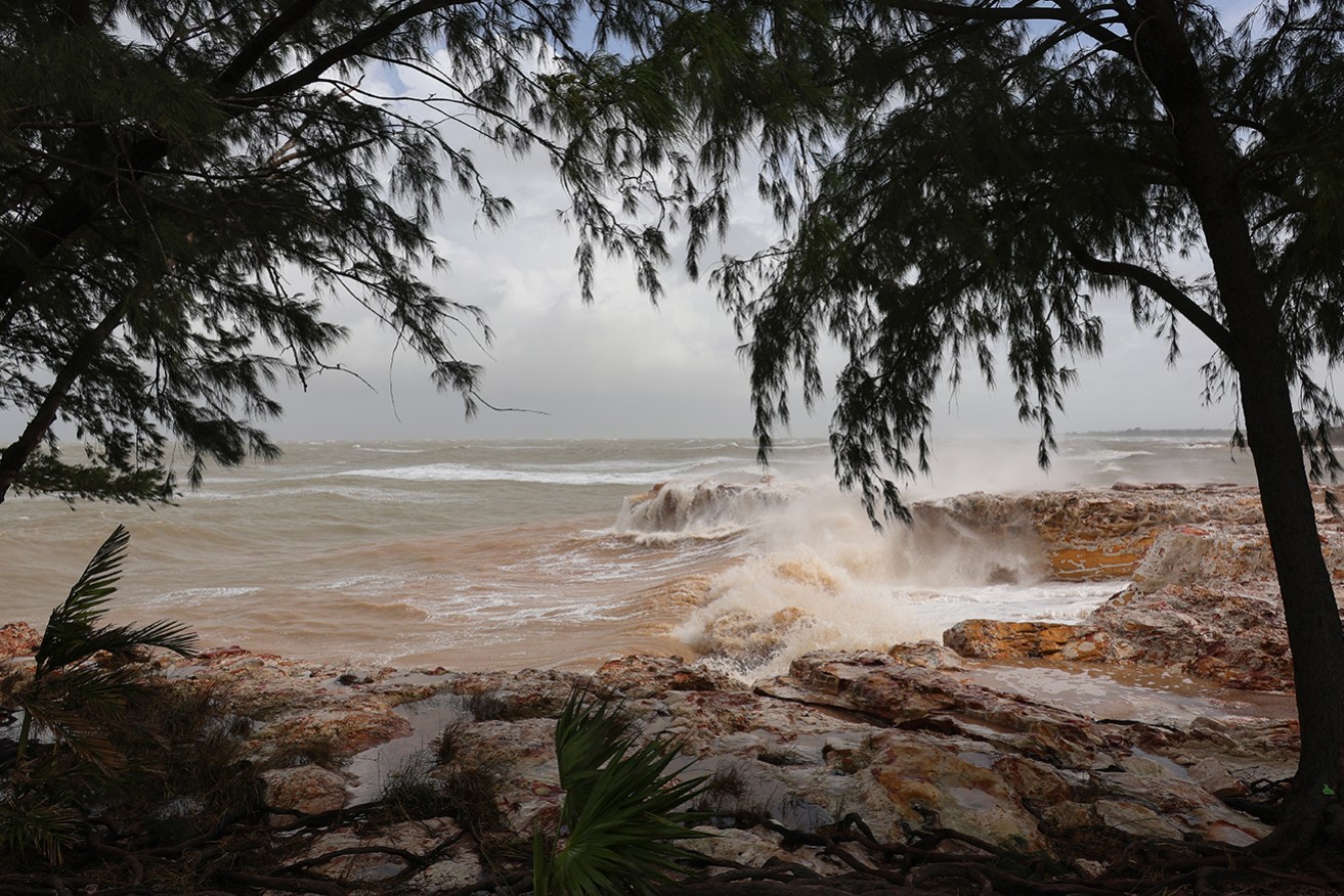
Tropical Cyclone Fina is already hitting island and coastal communities as it approaches Darwin. Photo: AAP
The first cyclone of the season is expected to intensify as it approaches northern Australia, prompting a warning for Top End residents to prepare for destructive winds.
Tropical Cyclone Fina weakened to a category one system overnight but is expected to restrengthen as it moves toward the Northern Territory.
Darwin has been placed in a “warning zone” amid fears the system could intensify into a destructive category three system later on Friday.
“Tomorrow will become the really big day, particularly around Darwin, as this category two tropical cyclone moves south-west-wards through the Van Diemen Gulf, past the Tiwi Islands, and just in the vicinity, probably somewhere just to the north of Darwin itself, bringing significant weather impacts to that part of the country tomorrow and into Sunday as well,” weather bureau senior meteorologist Angus Hine sid.
“So [it will be] very, very wet and very, very windy through the weekend.”
He said there had already been 200 millimetres of rain in some areas, with no sign of it easing.
Locals have stocked up on supplies as they brace for winds that could damage houses and vehicles, fell trees and cut power while “throwing around the outdoor furniture”.
Early on Friday, Cyclone Fina had sustained winds near its centre of 75km/h, with gusts up to 100km/h, and was about 335 kilometres north-east of Darwin, moving slowly.
The system is expected to continue south-west through the Van Diemen Gulf on Saturday, heading just to the north of Darwin.
The Bureau of Meteorology said there was a chance it could reach category three intensity late on Friday or early Saturday as it moved into the Gulf.
A warning zone was issued early on Friday for Darwin, the Tiwi Islands and Cape Hotham to Warruwi, including the Cobourg Peninsula, Minjilang and Gunbalanya.
Damaging wind gusts of up to 120km/h over the Cobourg Peninsula may hit on Friday, with gales expected to extend further west to include the Tiwi Islands later in the day, and Darwin on Saturday.
Destructive wind gusts up to 155km/h may develop between Cape Don and Warruwi on Friday as the system nears the coast, extending to the Tiwi Islands early on Saturday and possibly to Darwin later in the day.
The bureau warned that heavy rain could cause flash flooding in coastal areas between the Tiwis and Warruwi from Friday, extending to the coast and nearby inland areas, including Darwin, on Saturday.
Coastal residents on the Tiwis and between Cape Hotham and Warruwi are warned of a dangerous storm tide.
Top End residents have been stocking up on basics with bottled water, bread, canned goods and other household supplies flying off supermarket shelves.
Multiple weekend sports and entertainment events have also been cancelled.
Emergency Management Minister Kristy McBain said the emergency operations centre in Darwin was up and running and generators had been sent to affected areas.
“It is really important now for community to listen to those emergency warnings from Secure NT, their emergency radio broadcasting channels, and we are asking community members to look out for vulnerable community members as well,” she said.
“We’ll continue to work with the Northern Territory Government over the next 24-48 hours on other requests for assistance.”
By late Sunday, conditions in the Top End will start to ease as Fina moves into Western Australia.
Hines said Fina should have cleared the NT by Wednesday.
Darwin residents have been urged to ensure they have an emergency plan and to shelter at home, with most buildings made to withstand cyclones.
Cyclone Tracy was the most devastating system to hit Darwin, killing 66 people after it was destroyed on Christmas Day in 1974.
-with AAP
Want to see more stories from The New Daily in your Google search results?
- Click here to set The New Daily as a preferred source.
- Tick the box next to "The New Daily". That's it.


